


MOUNDS 2 Voting District, Pulaski County, Illinois
About
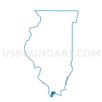
Outline

Summary
| Unique Area Identifier | 574021 |
| Name | MOUNDS 2 Voting District |
| County | Pulaski County |
| State | Illinois |
| Area (square miles) | 8.12 |
| Land Area (square miles) | 8.05 |
| Water Area (square miles) | 0.08 |
| % of Land Area | 99.06 |
| % of Water Area | 0.94 |
| Latitude of the Internal Point | 37.13144190 |
| Longtitude of the Internal Point | -89.23176390 |
Maps


Graphs
Select a template below for downloading or customizing gragh for MOUNDS 2 Voting District, Pulaski County, Illinois


Neighbors
Neighoring Voting District (by Name) Neighboring Voting District on the Map
- CACHE Voting District, Alexander County, IL
- MOUNDS 1 Voting District, Pulaski County, IL
- MOUNDS 3 Voting District, Pulaski County, IL
- SANDUSKY Voting District, Alexander County, IL
- VILLA RIDGE - AMERICA Voting District, Pulaski County, IL
Top 10 Neighboring County Subdivision (by Population) Neighboring County Subdivision on the Map
- Mounds precinct, Pulaski County, IL (1,319)
- Sandusky precinct, Alexander County, IL (538)
- Villa Ridge precinct, Pulaski County, IL (490)
- Cache precinct, Alexander County, IL (413)
Top 10 Neighboring Place (by Population) Neighboring Place on the Map
Top 10 Neighboring Unified School District (by Population) Neighboring Unified School District on the Map
- Egyptian Community Unit School District 5, IL (3,878)
- Meridian Community Unit School District 101, IL (3,533)